The Donnersberg Mountain near Dannenfels holds plenty of photographic highlights. It is crisscrossed by many beautiful hiking trails and offers a multitude of impressive viewpoints. Join me on a photo hike to Donnersberg Mountain and the Adlerbogen (eagle’s bow).
Starting point near Dannenfels
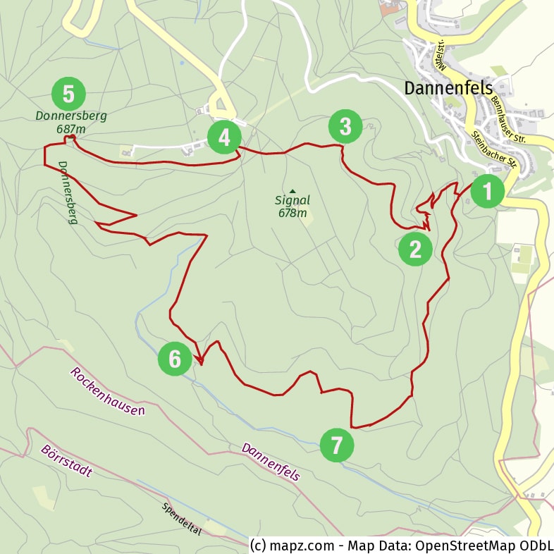
Donnersberg Mountain is part of the Nordpfälzer Bergland, a low mountain range in Rhineland-Palatinate. The hike begins in the village of Dannenfels, at a parking lot (1) on the eastern flank of the mountain. In Dannenfels itself, by the way, you should definitely take a look at the so-called “Dicke Keschde”, a huge chestnut tree from 1380 with a trunk circumference of about nine meters.
Sunrise at Adlerbogen
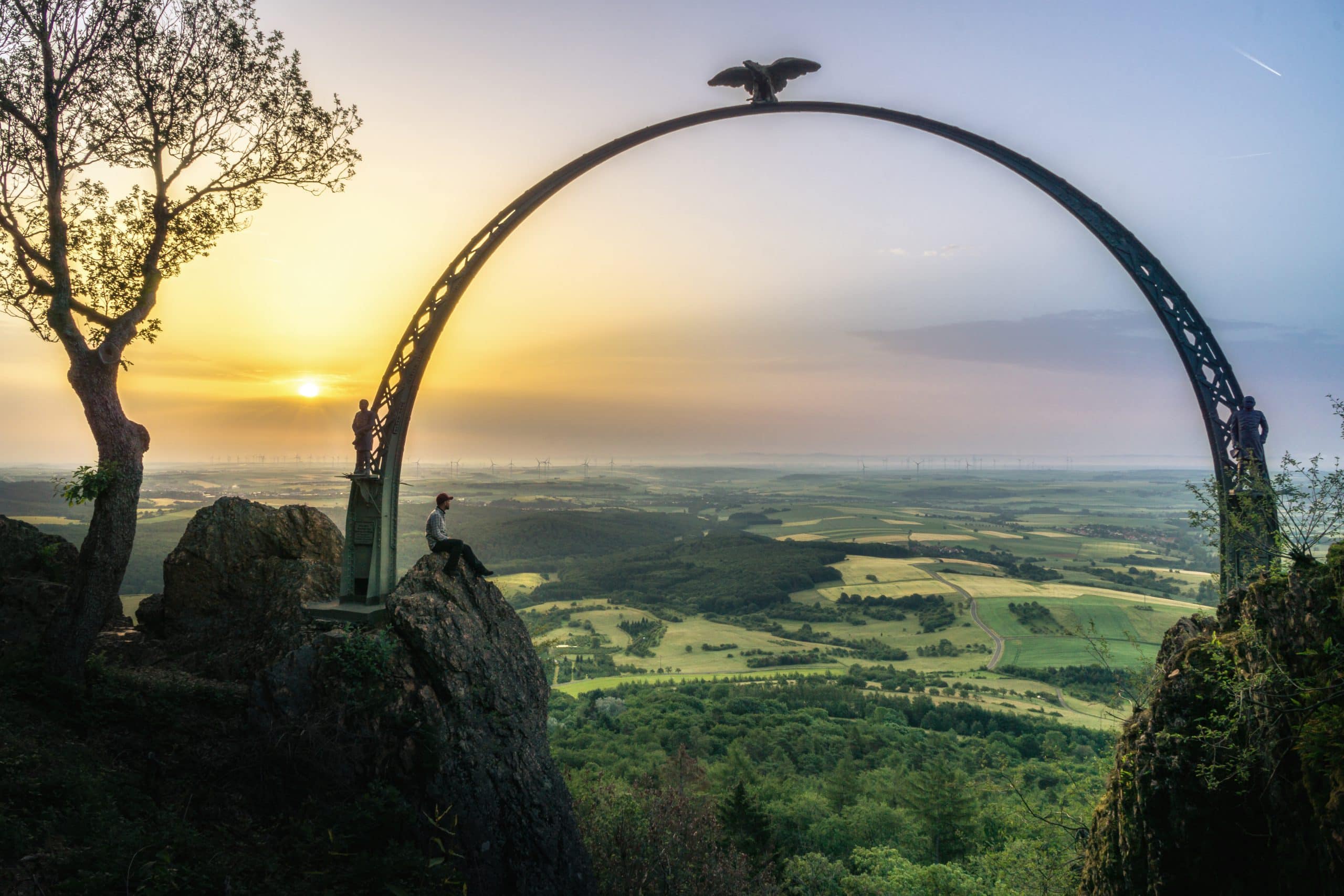
After only 800 meters we reach the most interesting spot of the hike (from a photographic point of view): the Adlerbogen (2). It is a triumphal arch from 1880. It spans over a width of 12 meters between two rocky peaks of the Moltke Rock. In between is a 30-meter deep abyss. The view to the east is breathtaking and reaches as far as the city of Worms, 30 kilometers away. One should definitely take a picture of the sunrise here, framed by the Adlerbogen.
Along the sculpture trail to Hirtenfels
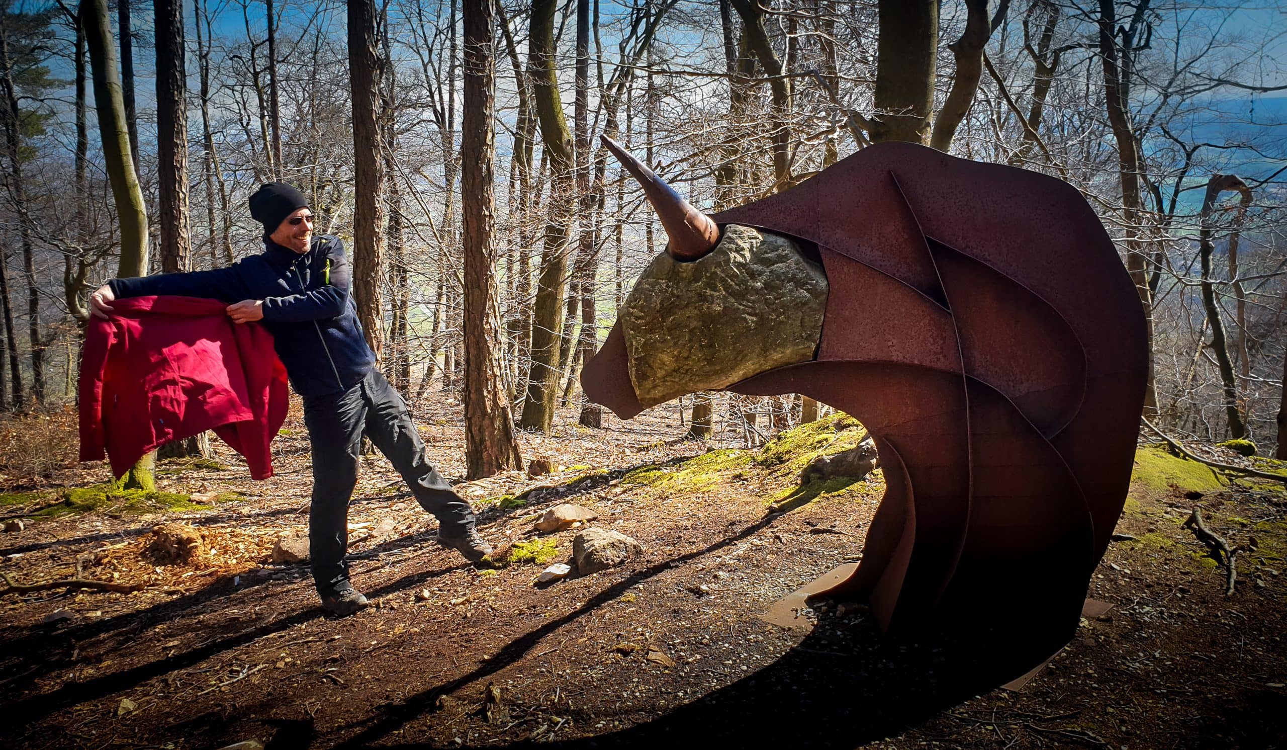
From the Adlerbogen a beautiful hiking trail leads through the forest in a north-western direction to the Hirtenfels (shepherds’ rock) (3). Along the way, there is a series of Celtic sculptures that belong to the Donnersberger sculpture trail (this trail leads south to a reconstructed Celtic village in Steinbach – especially worth a visit with children). From the Hirtenfels, there is also a beautiful view.
Ludwigsturm and Celtic Settlement

The next point on the hike is the Ludwigsturm (4), a 27-meter-high observation tower dating from 1864, named after the Bavarian King Ludwig II. On weekends the tower can be ascended. In the direct surroundings of the tower are the excavation sites of a Celtic ring wall (oppidum). Around the year 150 B.C., one of the most important Celtic settlements north of the Alps was located here.
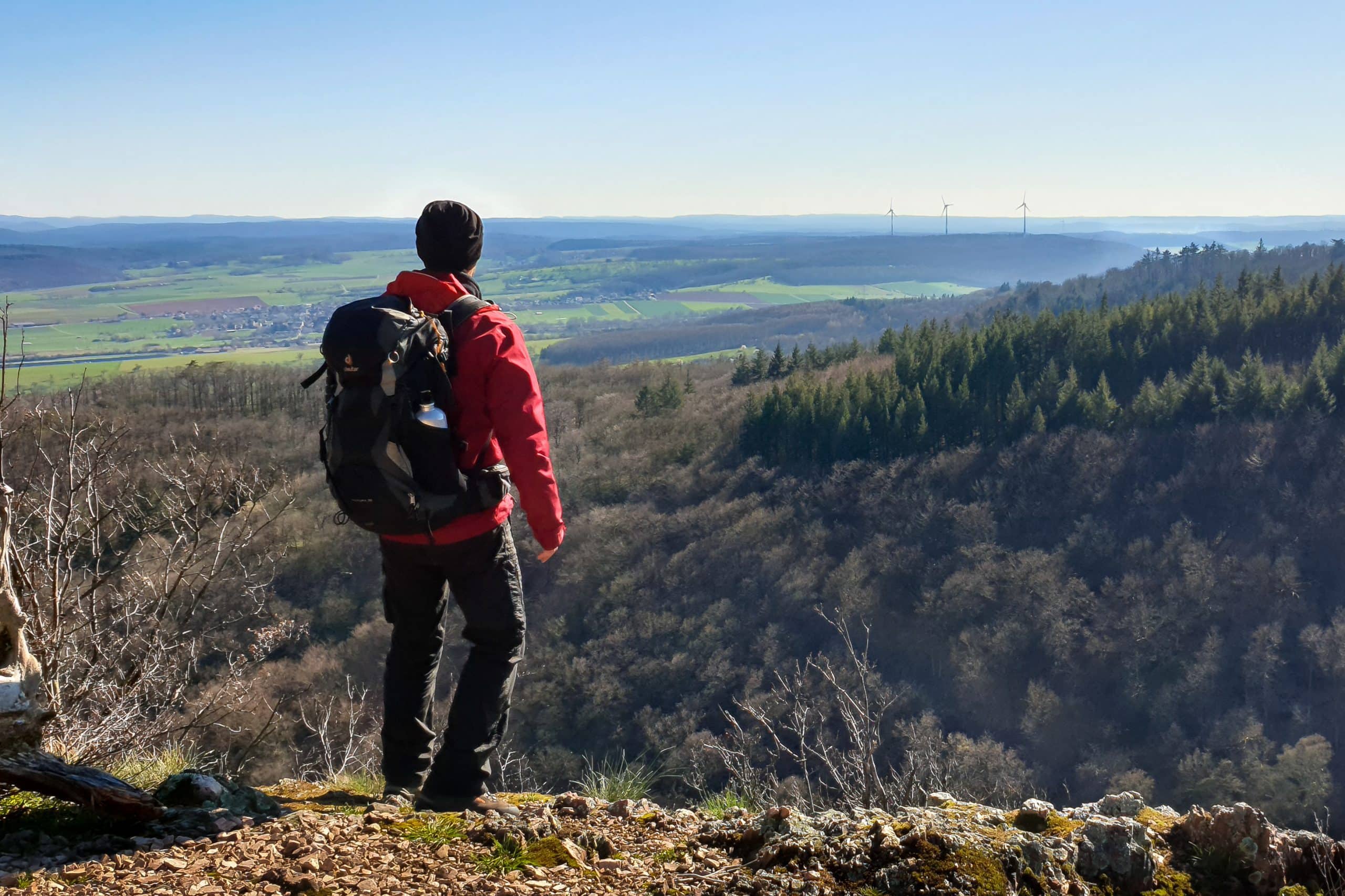
Mountain peak: Königsstuhl
We walk directly over the Celtic rampart westwards to the highest point of Donnersberg Mountain, a rock which is called Königsstuhl (5) because of its throne-like shape. From here you have a far-reaching view to the northwest, as far as the Hunsrück mountain range.
Wildenstein Castle
Then we turn southeast and walk down the mountain flank to the ruins of Wildenstein Castle (6). It dates from about 1200 and is located on a steep mountain slope, well hidden between the trees. You probably won’t find any special photo motives here, but it is a great place for a picnic.
Last point before returning to the parking lot is the beautiful viewpoint “Reißender Fels” (7).
If my Photo-Hike to Donnersberg Mountain and Adlerbogen inspired you to own photographs, please leave a comment down below and/or share this blog post with your friends. Thank you!
- The reconstructed Celtic village in Steinbach: www.keltendorf-steinbach.de
- Sculptures-Trail from Steinbach to Donnersberg Mountain: PDF-Flyer
Here you can download a detailed PDF Sheet of this photo-hike for printing. It contains a description of the location and tips on how to get there. The file contains both an English and a German version.
 On this blog, I record my adventures, journeys, experiences, thoughts, and ideas. If you don't want to miss any of it, subscribe to my newsletter.
0 Comments